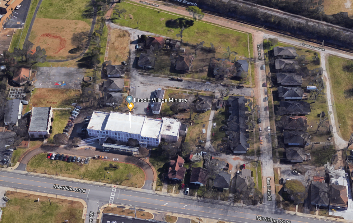
 There is a small community in northeast Huntsville called Lincoln Village. 15 years ago a good friend and pastor started a conversation with a little girl who turned into a commitment and lead to a big project called Lincoln Village Preservation Corporation.
Today LVPC owns that little girl’s house and dozens around it. The place has been transformed into a real neighborhood where families live and work and encourage their kids in the -rather excellent- neighborhood school, which LVPC also owns and operates. The project is, in the vernacular, Faith-Based in a way that we really mean. By Faith-based, Lincoln believes that all of the work that was accomplished belongs to God and the Holy Spirit he left here on Earth with us. That is what is happening at Lincoln, despite the involvement of the flawed and broken sinners that he calls to work and to leadership.
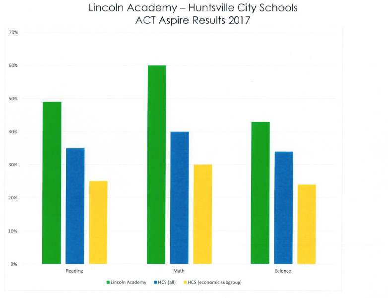
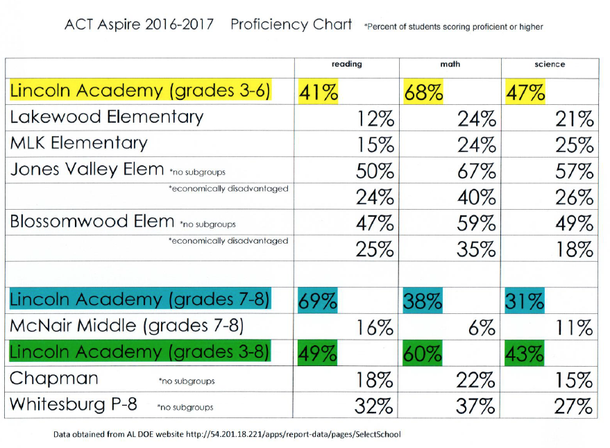
So it is with some emotion other than pride that I share these stats with you. I am proud of the kids and what they have done. But I am astonished at the accomplishments of our Creator. Something well beyond and not quite the same thing. It’s more like awe and maybe fear. Like when you stand on the rim of the Grand Canyon. It’s beautiful, yes, it’s also so much bigger than I am that it’s scary. Anything that enormous, that close to you, just gets your attention. Lincoln is that kind of place.
I have included some stats about the school in this post and I want to post some more in the next few weeks. I just rolled off as Chair of the Board at the end of July and I want to leave a few records of my time there. I have been blessed to be involved with some amazing people working with “non-profits” but Lincoln is a truly special place.
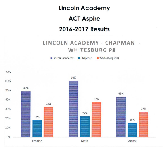
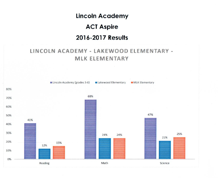
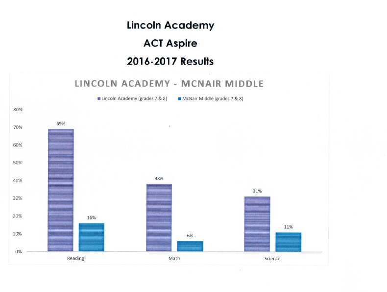
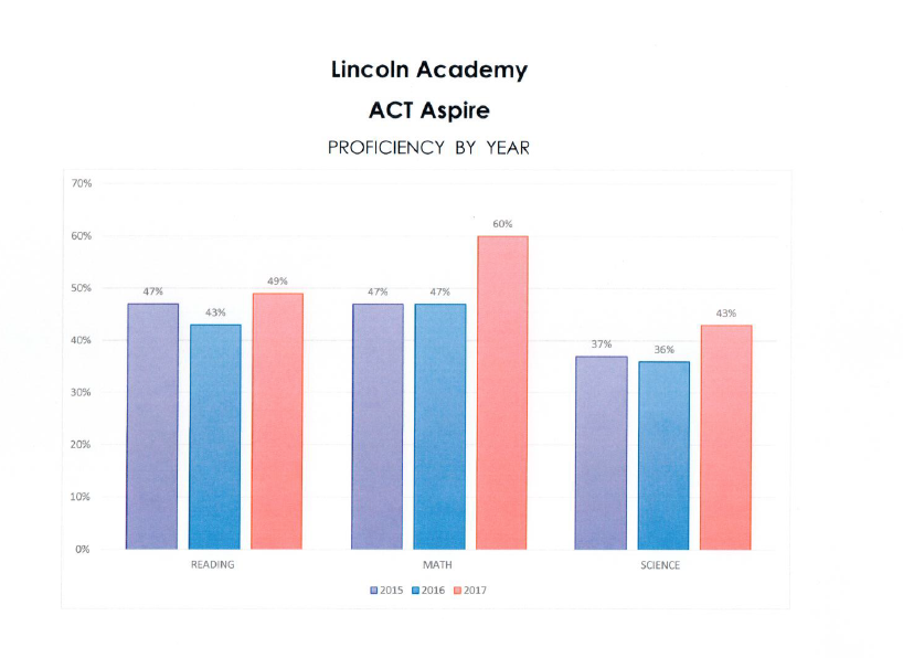
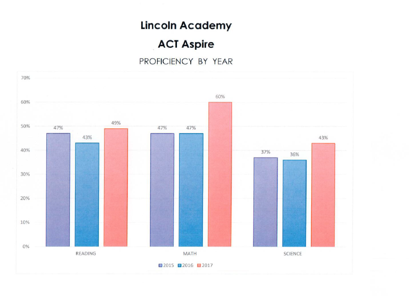
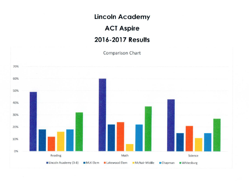
So, here are some stats. My big takeaway is: our kids are as smart as your kids. Maybe smarter. That is not amazing or even surprising. It’s just that they do not come from a culture that values academic achievement, so they don’t. But when they are shown how valuable, how transformational, a book or a formula can make them. They get it. They are empowered and they excel. Check these out!
Note: while I am super-pumped about Lincoln’s scores, it is important to realize that we have less than 100 kids compared to over 20K in the City system. We are making a difference in the lives of our families but so much more needs to be done if we are to impact the whole city like we have Lincoln. Like the Holy Spirit has I mean. I am convinced that we do little more than make things more complicated.
If you are inspired at all to get involved in changing the city, I’d suggest you reach out to Lincoln. Come to the website and look at the volunteer opportunities. If you can’t, and you should, you can always donate too.
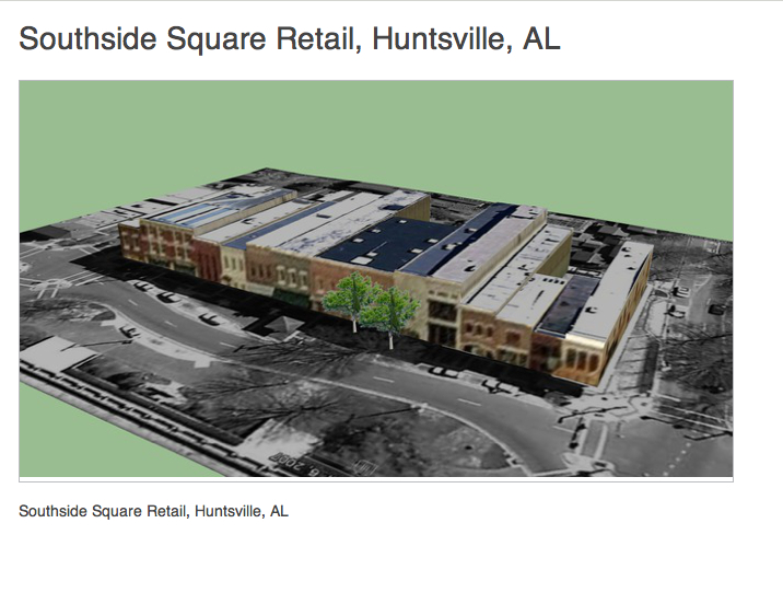 There is a new event coming up in Downtown Huntsville called a Map-a-Thon. It’s a competition put on by